
| 倾斜摄影模型 |
在SuperMap iClient3D for Plugin中,倾斜摄影模型同其他三维模型一样,支持各类三维空间分析功能,包括通视分析、(动态)可视域分析、天际线分析、阴影率统计分析、剖面线分析等,有关三维空间分析内容请参考“三维空间分析”专题文档。
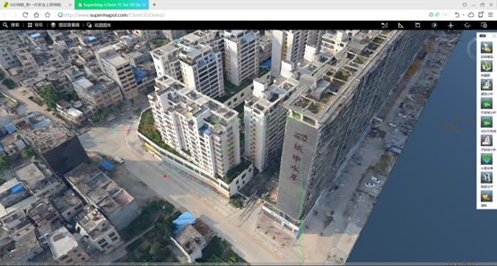
图 4‑1 通视分析
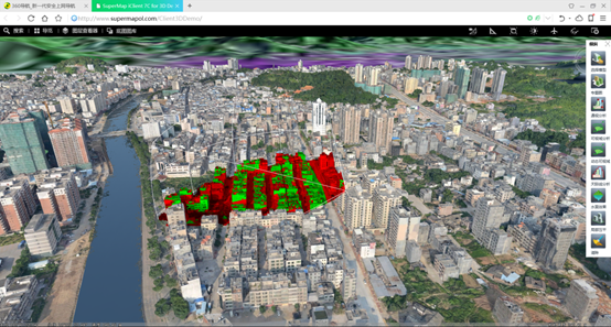
图 4‑2 可视域分析
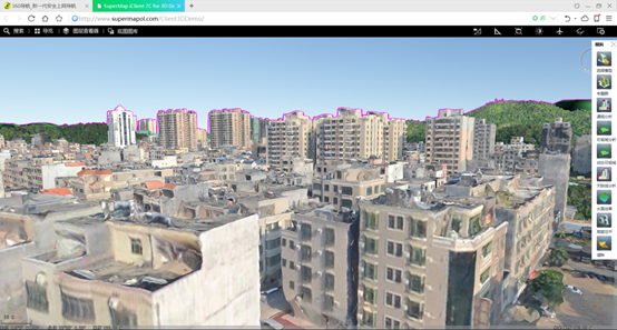
图 4‑3 天际线分析
为满足规划等行业应用需求,SuperMap iClient3D for Plugin提供了局部压平功能,支持三维面数据压平倾斜摄影模型的局部区域,模拟拆除建筑物的效果,并可置换为精细模型,实现规划方案效果对比与展示。
如下代码示范了如何压平倾斜摄影模型的局部区域。
function FlattenLayer() { sceneControl.set_sceneAction(null); //将场景交互操作设置为绘制三维面,DrawRegion3D通过扩展SceneAction类实现特定的交互功能 var newAction = new SuperMap.Web.UI.Action3Ds.DrawRegion3D(sceneControl); sceneControl.set_sceneAction(newAction); } |
以下代码示范了如何扩展SceneAction。扩展类的名为 DrawRegion3D,实现了绘制三维面和局部压平倾斜模型的功能。
SuperMap.Web.UI.Action3Ds.DrawRegion3D = function (sceneControl) { SuperMap.Web.UI.Action3Ds.DrawRegion3D.initializeBase(this); this._name = "DrawRegion3D"; this._sceneControl = sceneControl; this._points = new SuperMap.Web.Core.Point3Ds(); this._geoRegion3d = new SuperMap.Web.Core.GeoRegion3D(); this._point; //三维操作状态类型为点选 this._type = SuperMap.Web.UI.Action3Ds.SceneActionType.POINTSELECT; this._id1;//记录静态id this._id2;//记录动态id this._count = 0; this._style = new SuperMap.Web.Core.Style3D(); }; SuperMap.Web.UI.Action3Ds.DrawRegion3D.prototype = { dispose: function () { this._sceneControl = null; }, //鼠标左键按下后触发事件 onMouseDown: function (e) { //高度模式为绝对高度 this._style.set_altitudeMode(2); //设置点对象颜色 this._style.set_markerColor(new SuperMap.Web.Core.Color(0, 255, 0, 255)); //设置填充前景色 this._style.set_fillForeColor(new SuperMap.Web.Core.Color(255, 255, 0, 100)); var trackingLayer = this._sceneControl.get_scene().get_trackingLayer3D(); //按键为鼠标左键时添加三维点对象 if (e.get_flagType() % 2 == 1) { var pt = new SuperMap.Pixel(e.get_clientX(), e.get_clientY()); this._point = this._sceneControl.pixelToGlobe(pt, SuperMap.Web.Realspace.PixelToGlobeMode.TerrainAndModel); var geoPt = new SuperMap.Web.Core.GeoPoint3D(this._point); var feature = new SuperMap.Web.Core.Feature3D(); feature.set_geometry(geoPt); this._points.add(this._point); this._count++; } else { if (this._count > 2) { var panAction = new SuperMap.Web.UI.Action3Ds.Pan(sceneControl); sceneControl.set_sceneAction(panAction); //向三维面追加一个子对象 this._geoRegion3d.addPart(this._points); var feature = new SuperMap.Web.Core.Feature3D(); feature.set_geometry(this._geoRegion3d); feature.set_style3D(this._style); _index++; //向跟踪图层添加一个三维面对象 trackingLayer.add(feature, "region_" + _index); //添加压平区域 osgbLyr.addFlattenRegion(this._geoRegion3d, "region_" + _index); } } } }; SuperMap.Web.UI.Action3Ds.DrawRegion3D.registerClass('SuperMap.Web.UI.Action3Ds.DrawRegion3D', SuperMap.Web.UI.Action3Ds.SceneAction, Sys.IDisposable); |
倾斜摄影模型的局部压平效果如下图所示:
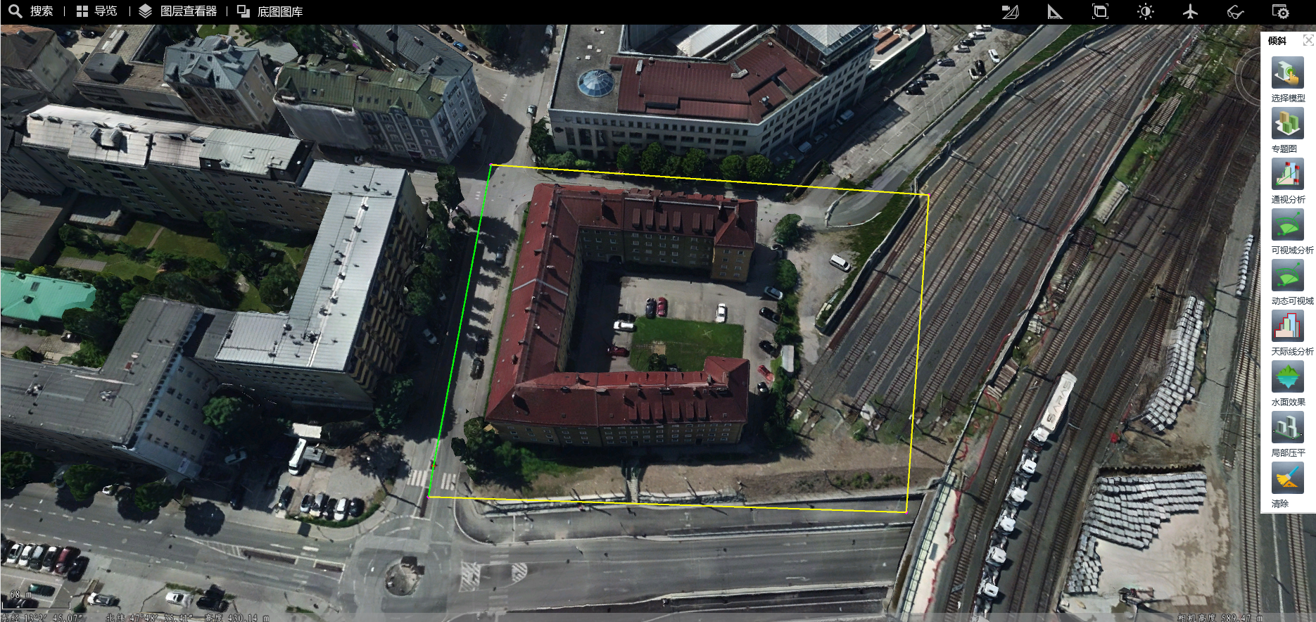
图 4‑4 点选绘制待压平区域
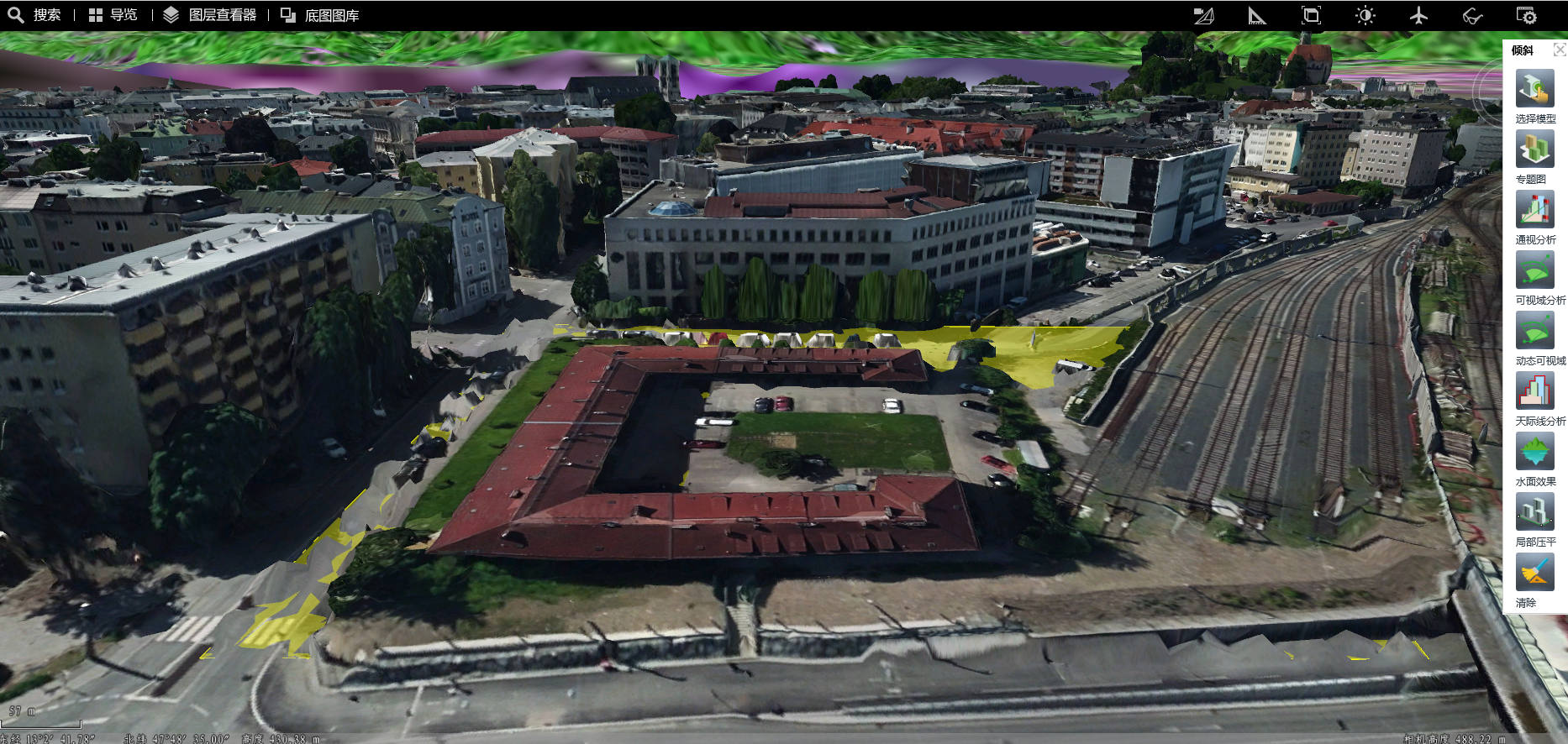
图 4‑5 倾斜模型压平后效果